Stuarts Point groundwater update #8
Published on 30 March 2022
Key updates
An evacuation warning was issued at 4pm for Stuarts Point and surrounds.
NSW SES is advising residents in Stuarts Point to prepare for possible evacuation due to possible contaminated floodwater and rising groundwater levels.
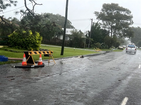
Pumping efforts have continued throughout the day with four pumps operating. A fifth pump is arriving Wednesday night for use on Thursday.
Please do not drive, ride, walk or play in floodwater or surface water as it may pose a health risk.
Please reduce use of onsite sewage management systems as much as possible. Council is carrying out inspections for possibly flooded systems and a thorough inspection of onsite sewage management systems will occur on Thursday.
Extra resources have been requested and are in place from Fire and Rescue and RFS.
If you need emergency help with flooding in your property call the NSW State Emergency Service on 13 25 00.
In life-threatening situations call triple zero (000) immediately.
Showers and toilets open
If groundwater is covering household septic tanks, please minimise use of water in your homes, especially showers and toilets.
Stuarts Point Holiday Park and Grassy Head Holiday Park toilet and shower blocks are open for impacted residents. Any resident needing to use the showers should park in the foreshore public car park and go to reception who will give directions and the access code.
Toilet blocks at the sports fields and foreshore are also open.
Groundwater levels
Groundwater levels at Bore 1 are still rising, recording approximately 0.08m in the last 6 hours and are approximately 0.14m below the level seen in March 2021 Flood Event.
The Bureau of Meteorology has issued a Minor to Moderate Flood Warning for the Macleay River as well as a Severe Weather Warning for the northern parts of the Mid North Coast.
Council are in constant contact with other key agencies to ensure a full response to any and all situations.
Council staff and emergency services are monitoring the situation on the ground and through groundwater level monitors.
Residents should monitor conditions at their own properties and act accordingly.
Readings taken at 5pm Wednesday 30 March 2022.

How to read this diagram
The diagram shows the groundwater level for the past 30 days. The three graphs essentially present the same data but each with relation to a different reference point (or datum).
- The blue graph shows the depth of water below the Mount Point, which is where the laser that takes the reading is mounted.
- The red graph shows the height of the water above the Australian Height Datum (AHD) which is the official height metric based on the average of sea levels from 1966-68.
- The green graph shows the depth of the water below ground level at the location of the meter.