Macleay Valley Flood Update #4
Published on 01 March 2022
KEMPSEY SHIRE COUNCIL FLOOD UPDATE #4
Update as at 4.30pm Tuesday 1 March 2022
KEY CHANGES
- The Macleay River remains on a minor flood warning - Flood Warning - Macleay River (bom.gov.au)
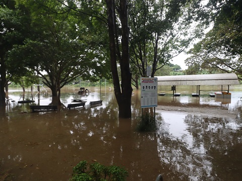
- The Macleay River at Kempsey is expected to peak throughout today at approximately 4.8m with minor flooding.
- Upstream of Kempsey, Bellbrook peaked below the minor flood level (6.50 metres) overnight Tuesday into Wednesday.
- Many river crossings remain closed
- Ryan’s Cut Outlet has been successfully opened to the ocean.
FLOOD WARNING
The Bureau of Meteorology has issued Minor Flood Warning #5 for the Macleay River at 12:49pm on Tuesday 1 March 2022.
The warning states “The Macleay River at Kempsey (AHD) is approaching a minor flood peak around 4.80 metres.
The Macleay River at Smithtown may reach around 3.30 metres Tuesday afternoon, near the minor flood level (3.40 metres).”
For up-to-date warnings head to Flood Warning - Macleay River (bom.gov.au)
RIVER LEVELS AND TRENDS
The following gauge and manual readings are being used to monitor the situation.
- Georges Creek – 4.57m at 3pm - FALLING from 4.80m at 11am
- Bellbrook – 5.32m at 3.43pm - FALLING from5.69m at 11.43am
- Toorooka – 6.16m at 3.33pm – FALLING from 6.37m at 11.30am
- Turners Flat – 6.42m at 3.15pm – FALLING from 6.50m at 11am
- Sherwood Bridge – 6.54m at 3.39pm – STEADY from 6.51m at 11.44am
- Kempsey Traffic Bridge – 4.87m at 3.40pm – RISING from 4.72m at 11.37am
- Smithtown – 3.31m at 3.30pm – RISING from 3.23m at 11:45am
Residents are advised to monitor the river levels via the Bureau of Meteorology website and act accordingly.
DRIVING CONDITIONS
Please do not take unnecessary risks and do not drive through flood waters.
If you are in a known flood-prone area, we encourage you to take note of the current conditions and assess if you should implement your flood plan.
Flood damage to road, bridge and drainage infrastructure could be present in several locations, if you are travelling exercise great caution.
Please note, there is WATER OVER THE ROAD in the following locations:
- Collombatti Road near Cummings lane.
- Beranghi Road
- Point Plomer Road
Check with RMS www.livetraffic.com or 132 701 for more road status information.
RIVER CROSSINGS
All bridges that cross the Macleay River upstream of the Kempsey Traffic Bridge are now closed.
- Bellbrook Bridge is CLOSED
- Temagog Bridge is CLOSED
- Toorooka Bridge is CLOSED
- Turners Flat Bridge is CLOSED
- Sherwood Bridge is CLOSED
- Dungay Creek and Dowlings Falls causeways are CLOSED
At present the following roads have been marked as CLOSED:
- Armidale Road at Flying Fox, 20-30km into Armidale Regional Council’s LGA area is CLOSED
- Gladstone Street Underpass, between Kemp Street and First Lane Intersections is CLOSED
- Queen Street Causeway is CLOSED
- Second Lane is CLOSED
- Bloomfield Street, between Macquarie and Prince Street is CLOSED
FLOODGATES
Council closed the flood infrastructure during the day on Thursday 24 February 2022.
- The floodgates on Kinchela Creek, Belmore River, Christmas Creek and Euroka Creek are CLOSED
- Flood relief gates at Kinchela Creek and Belmore River are CLOSED.
- Ryan’s Cut Outlet has been successfully opened to the ocean.
Please note, as the predicted Macleay River flood peak is being experienced, the water level in the Kinchela Creek and Belmore River is close to the required level for opening the flood relief structures.
Landholders are encouraged to be prepared in the event an unexpected river rise occurs and the relief gates at Kinchela Creek and Belmore River are required to be opened.
SEWER
- During heavy or sustained rain events it is not uncommon to experience sewer overflows in our sewer catchment areas, nor are they preventable, as sewerage systems are not designed to transport storm water in these events.
- Our teams are continuing to monitor the situation and conducting the required sampling, reporting and clean up in these areas.
FLOOD CAMERAS
The most recent images from flood cameras on the Macleay River are available at ksc.pub/flood
The flood monitoring camera at Sherwood Bridge, west of Kempsey, is focused on the bridge deck so residents can see if the bridge is being affected by flooding.
Images are updated every 30 minutes. Please note the time stamp is set to Australian Eastern Standard Time NOT to Australian Eastern Daylight Saving Time.
SANDBAGS
If you need sandbags to protect your home or business contact the local SES on 13 25 00. Please be patient with the SES while they endeavour to get to you.
WHAT SHOULD YOU DO?
Council urges people to:
- Remain cautious on the roads for localised impacts, DO NOT attempt to drive through flood waters or cross flooded bridges.
- Consider the impact of possible road closures and flood isolation on work, family and educational commitments
- Monitor emergency warnings and severe weather updates
- If your property is at risk of inundation, please raise moveable items, such as furniture, as high as possible onto benches or tables, placing electrical items on top
- If you live in a low-lying area and are advised by an emergency services officer to evacuate, please do so
- Secure outside belongings and before leaving, turn off the power and water and take pets, essential medicines and clothes with you
COUNCIL SERVICES AFFECTED
A number of Council services can be impacted by flood events including sports fields, waste centres and libraries. We will update on these changes as they are confirmed.
COUNCIL CREWS MONITORING THE REGION
Council's work teams are inspecting roads and areas of concern and we will advise of developments in future updates.
Council are currently stretched, flood damage could be present in several locations if you need to travel please exercise caution.
Council welcomes advice from residents in outlying areas regarding any concerns which may be reported to Council on 6566 3200 however our Customer Service Centre is currently experiencing a high volume of calls so please check that your concerns have not already been addressed online.
For emergency help in floods and storms, call the NSW State Emergency Service on 132 500. In life-threatening situations call triple zero (000) immediately.
FOR MORE INFORMATION
- Check Council's automatic Disaster Dashboard at ksc.pub/disasterdashboard
- Listen to local ABC, the emergency broadcaster, on 95.5 FM or 684 AM
- Follow NSW SES on Facebook or www.ses.nsw.gov.au
- Latest Weather, Warnings, Rainfall and River heights: www.bom.gov.au/nsw
- Road Closures and traffic info: RMS www.livetraffic.com or 132 701
NEXT UPDATE
Council will post updates to our website and Facebook page as information becomes available.
The next update will be published at around 7.30am Wednesday 2 March unless there is a significant change in the situation.